Archaeological map offers guide for contested sites
In an effort to offer a guide for the division of archaeological sites between Israel and Palestine in the event of a peace agreement, the USC Digital Library earlier this week presented the first public map of the sites based on research commissioned by a USC professor and other researchers.
The West Bank and East Jerusalem Searchable Map, using a Google map interface, on the library’s website, includes the names, locations, components and periods of nearly 7,000 archaeological sites in the contested region.

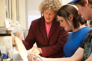
Border crossing · Lynn Dodd, a project leader for the West Bank and East Jerusalem Searchable Map, examines an ancient Egyptian gravemarker with senior Jenny Crawford. - Dieuwertje Kast | Daily Trojan
The map was an initiative of the Israeli-Palestinian Archaeology Working Group, which includes Lynn Dodd, a lecturer of religion at USC, curator of the USC Archaeology Research Center and one of the project leaders; Ran Boytner, director of international research at the UCLA Cotsen Institute of Archaeology; and a team of prominent Israeli and Palestinian archaeologists and negotiators.
The group was created in 2005 to negotiate a plan on how to govern the archaeological sites in Israel and Palestine if a peace deal is brokered between the two sides.
“You cannot get a good divorce unless you know who has what,” Boytner said. “Now, when the negotiators are talking about dividing the border, they will have that information.”
Dodd and Boytner, who met as graduate students at UCLA, said they began the project after discovering that, unlike other issues like refugees and the fate of Jerusalem, nothing had been done to address the archaeological sites in the region.
“We realized that there was no way anyone could negotiate terms for archaeology because the records didn’t exist,” Dodd said. “The last 40 years of Israeli archaeology in the occupied territory was not publicly available.”
Dodd said she believes the map fills a void in the painting of a complete picture of not only Israel, but also the surrounding countries of Jordan and Syria. Without the map, she said, it would be impossible to write the history of archaeology in the region.
“It’s like trying to write the history of early colonial America with only information about eight colonies,” Dodd said. “There’s a huge hole. [The map] is a valuable resource if you’re trying to paint a complete picture of archaeology in this part of the world.”
The Israeli-Palestinian Archaeology Working Group collaborated with two researchers, Rafi Greenberg of Tel Aviv University and Adi Keinan of the University College London, to conduct research and collect data for the map of the archaeological sites. The research group was initially denied the information and sued the civil administration of the Israeli province in order to gain access to it.
After winning the suit and collecting the data, Dodd worked with Matt Gainer, director of the USC Digital Library and its information technology department to provide an avenue for everyone to view the data through the Google map.
“We are able to make the content available in a non-partisan environment — opening it up for broad inquiry and objective consideration,” Gainer said.
In recognition of this transparency and the political relevance of the map, the group won the 2009 ASOR Open Archaeology Prize from the American Schools of Oriental Research earlier this month. Ashley Sands, an alumna who worked with Dodd as an undergraduate studying archaeology, said the openness of the project sets it apart.
“One of the complaints I’ve heard from colleagues is that researchers have not been transparent with their work,” said Sands, who also co-founded a student group that discusses the relationship between archaeology, heritage and politics, with Dodd’s help. “The fact that this project was published for everyone to see directly combats that problem.”
The map is still a work in progress, according to Dodd, who plans to develop PowerPoint slides to give greater detail of the individual sites and eventually make the database downloadable.
For now though, Dodd said she is just happy that they were able to pull off the project after the obstacles they faced in collecting and presenting the data.
“We pulled together Israelis and Palestinians and created this resource so that it would help safeguard the archaeological heritage for the Israelis, for the Palestinians, and for everybody else,” she said.
